
“Are we going anywhere today?”
“Psheeeew… where do you want to go, Brianna?”
And so begins another Saturday morning before we even get out of bed.
Tahoe got dumped on with snow last weekend, so if we were going to go hiking, we’d have to find something lower elevation. So, we headed 2 hours northwest on highways 89 and 49 toward Downieville.
The snow walls along the highway got perpetually taller and more imposing as we wound through the tall Sierra pines and ascended toward Yuba Pass (6,709 feet) on Hwy 49. The Yuba Pass Sno-Park was hosting a legit chili cook-off in the parking lot. In addition to a full lot, a dozen or more vehicles were parked along both sides of the highway. If we had more time, we’d have loved to stop in.
Then, after we crested, the snow walls became smaller and smaller until the snow pretty much disappeared, the outside temperature crept closer and closer to 50º F, and the rushing North Yuba River came into view alongside us.
Hwy 49 parallels the river, so the road is very curvy. As we came around one curve, we had to slam on the brakes to avoid hitting four deer spanned across the entire roadway, with two more staring at us from the left side ditch. As we sat there and waited for them all to clear, I waved them on from the passenger seat as though they were pedestrians. 🤣
After a couple of minutes, all six deer made it across safely and frantically bounded up the vertical mountainside to our right. We slowly proceeded again, and just then, a seventh deer popped up from the left side ditch and so we slammed on the brakes again, and waited for it to cross. What excitement.
We arrived at Rocky Rest Campground, where we’d pick up the out-and-back hiking trail. The entire route is advertised as 14.5 miles round trip, but we’d planned on hiking out about 5.5 miles, then turning around, making it just over 11 miles total, which is plenty long, considering this is our second hike of the season, and we’d need to factor in 4 hours of driving.
The sky was a bit overcast. It wasn’t warm but it wasn’t cold out, but it was definitely more damp than we’re used to. Right away, we got to cross a long foot bridge that arched over the North Yuba River.


The floating machine in the river is called a “Rotary Screw Trap,” and the sign read that it is used for monitoring fish populations. (I specifically included the Ace Hardware bucket in the photo for “product placement” and a subtle shoutout to my husband’s Uncle Mark. 🤣).


Once we crossed the river, we banked left and continued wandering through the forest, paralleling the river, surrounded by a mixture of conifer and deciduous trees, lush ferns – and most everything was coated with a thick carpet of green moss, even the tree trunks! I kept calling them “furry trees.”


I haven’t been able to definitively confirm what it is, but to me, it looks like “fern moss” is an accurate name, so I’m going with that. The first time I’d seen similar fauna was while hiking on Stevens Trail back in 2016 with our friends Chad and Shannon. More recently, however, we saw some of this “fern moss” while hiking on the South Yuba Trail.

Even though the deciduous trees were still mostly “winter bare,” the area was fairly green, overall.

Ferns, moss, and creek intersecting the trail…

And even down to tiny succulents in the wild!

Some spots couldn’t have been much greener!


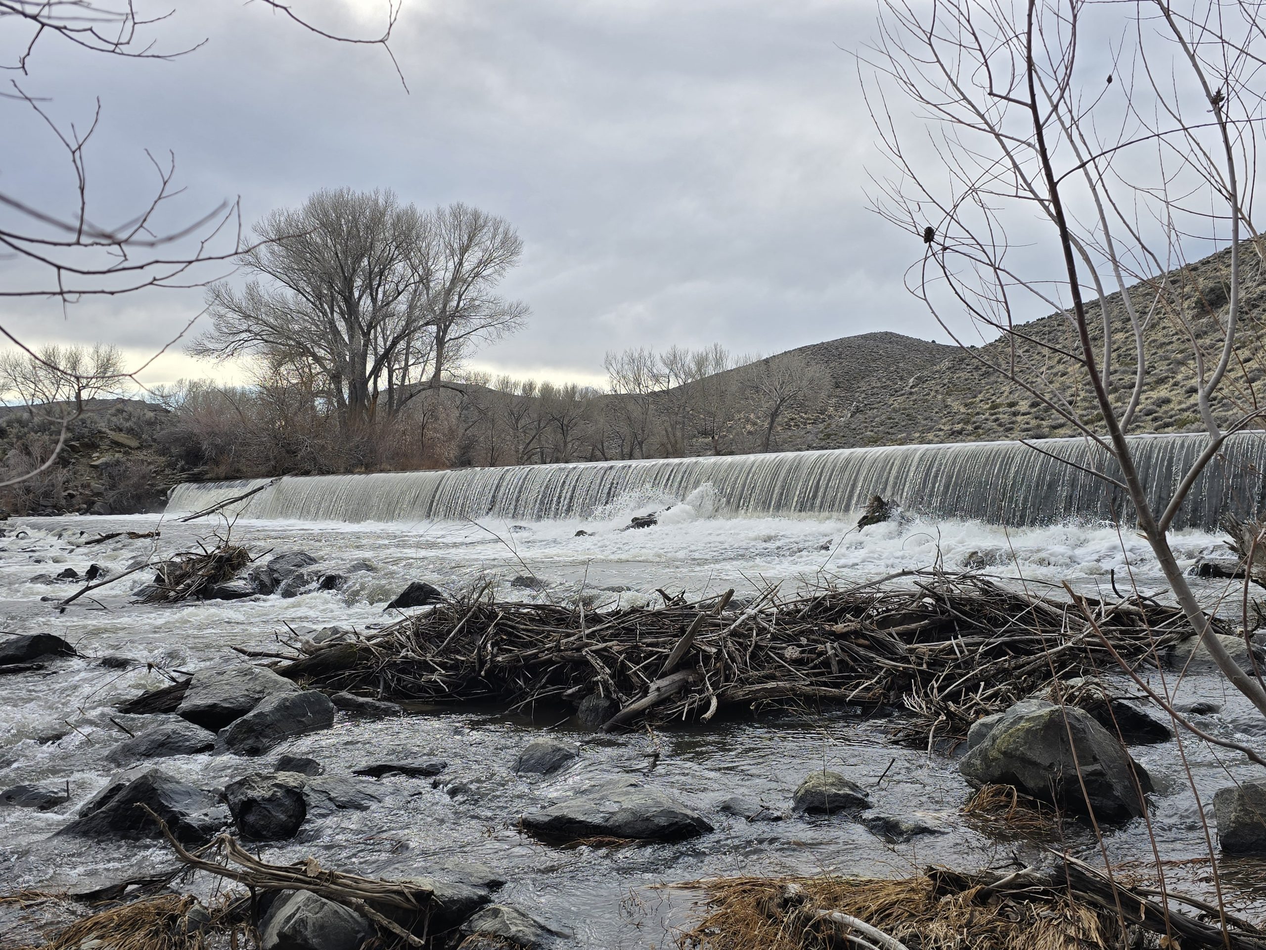
Early on in the hike, we came upon an opening that led down to the boulders of the North Yuba River below us. We felt compelled to venture down there to get a closer look and a feel for the water’s magnitude.


Outside of the rushing North Yuba River that was never out of earshot this entire hike, one of the notable features was all the little creeks and waterfalls along the route. There were so many, I lost count. A few had foot bridges, while most required employing some agility to rock-hop across and avoid dunking in your shoe. Or, if you’re my husband, you throw caution to the wind and just walk through the creek and deal with wet feet.


Then we came to the beautiful St. Catherine Creek.

I was a little obsessed with a lower part of the cascading falls that was surrounded by thick, lush mossy green, but I found it to be really difficult to get a photo of it that would do it justice (and without falling down the steep embankment). So, I tried to take a short video, but it still doesn’t capture how cool this little section was in person.

A substantial percentage of the trail was a shelf cut into the mountainside with a few sets of switchbacks. Another unique aspect to this trail was how varied the overall terrain was: From slightly muddy to soft dirt to oak leaf-covered to ankle-breaker rocks.


Along the route, we passed this neat little cave along the trail that was basically a mini-Weeping Rock from Zion National Park.

When we reached our halfway point at Devils Canyon, we took about 5 minutes to sit on large rocks and have some snacks alongside the creek, and then we started the trek up the switchbacks back to the trailhead before we got too chilly.

On our last hike, I learned what a “whoop-de-do” was. I can confidently say that this trail had a fair amount of whoop-de-dos from start to finish, so after 5 miles, fatigue started setting in my legs. I was not too excited about the numerous stretches of ankle-breaker rocks we were going to traverse on the way back. It’s like a special kind of torture for tired legs. There was definitely some stumbling going on.
I had to stop on this bridge and do some serious leg stretches.

The return route really started to feel long to both of us. Good thing the scenery was just as nice going the reverse direction.

Well, 11.33 miles and 5 hours later, we returned to the Jeep at the trailhead. My body was ready for a rest! And some food! We re-routed back to Downieville and stopped at a small riverside restaurant for a much-needed late lunch/early dinner before heading back to Tahoe.
Even though this hike felt long, for a girl who loves waterfalls (and bridges), all the cool creeks and falls on the route, plus the plethora of green moss and the weeping rock, made it worth the effort for this early-season spur-of-the-moment hike.

| North Yuba Trail hike | |
|---|---|
| Total Distance | 11.33 mi |
| Total Time | 5:00:03 |
| Total Ascent | 1,696 ft |
| Max Elevation | 2,865 ft |
Leave a Reply