
This weekend’s hikes were beautiful. Though not lengthy, they did test our agility (and our joints!). In fact, I worked in two different “recovery” workouts to combat the next-day crunchiness.
Since we were just recently hiking off of Ebbetts Pass, which had opened for the season four days prior, we decided to head to neighboring Sonora Pass on this beautiful Saturday. This year, the pass was fully opened on May 12, so we were cleared to go. It will take around 2.5 hours on the road to get to the trailhead from Tahoe. We set out generally south on Hwy 395 until we reached Hwy 108, which takes us over the pass through the Sierra Nevada.
As we climbed in elevation on the way to the trailhead, we could still see a bunch of the season’s remaining snow pack. In fact, enough was around that we saw numerous backcountry skiers and boarders parked along the highway. Deadman Creek, bordered by sketchy snow caves, parallels the highway and was really gushing along.
About 25 miles in is the well-known Kennedy Meadows Resort and Packstation. We’d been here at least once before to grab dinner following a hike. Sadly, the resort nearly burned down in September 2021’s wildfire, of which you could still see the burn scar up on the meadow’s surrounding ridge. I’m sure that scare runs its course here every summer.
We parked in the designated area and started down the wide forest road that leads to the formal trailhead for Relief Reservoir. The rushing, winding river on our right was moving at an impressive clip and the meadow was lush with trees budding out in electric lime green.


On the forest road, we came across several small groups of people and families heading back to the resort, many of whom were carrying fishing gear. Soon after, we crossed the first foot bridge with an impressive view of the rushing, cascading river.


And we got incredible views of some of the rocky ridges along the way.


I love giant trees. (And notice how nice this dirt trail looks… it doesn’t last…)

After this point, the trail continued a steady ascent, but it also got perpetually rockier.


We were surrounded by massive towering rock walls in the canyon, and the rushing river was down below us to the left as we climbed up.

Then we spotted an awesome waterfall flowing down a crevice between the rock walls.


Just after this point we crossed the next foot bridge, which spanned over a river-flowing canyon below.


Here’s the river flowing through the canyon just above the second foot bridge.


Then, the trail got even rockier.


And we came upon some random, discarded mining equipment along the side of the trail.

We carefully navigated our feet across the uneven rocks that made up the trail, and at around 7,000 ft., the terrain went back to alpine and the trail to dirt. My feet and legs welcomed this change! I was so giddy I felt like I should start jogging on this smooth ground. Then we arrived at the trail marker to lead us to the reservoir. It wouldn’t be long now! (Look at that nice, smooth trail!)


Well, that smooth terrain didn’t last. Once again, we found ourselves stepping up, over, around rocks and boulders as we approached the last ridge before our first views of the reservoir.

I figured this was where they put the misbehaving children on the trail. My husband corrected me, however, and said it was an old water heater.

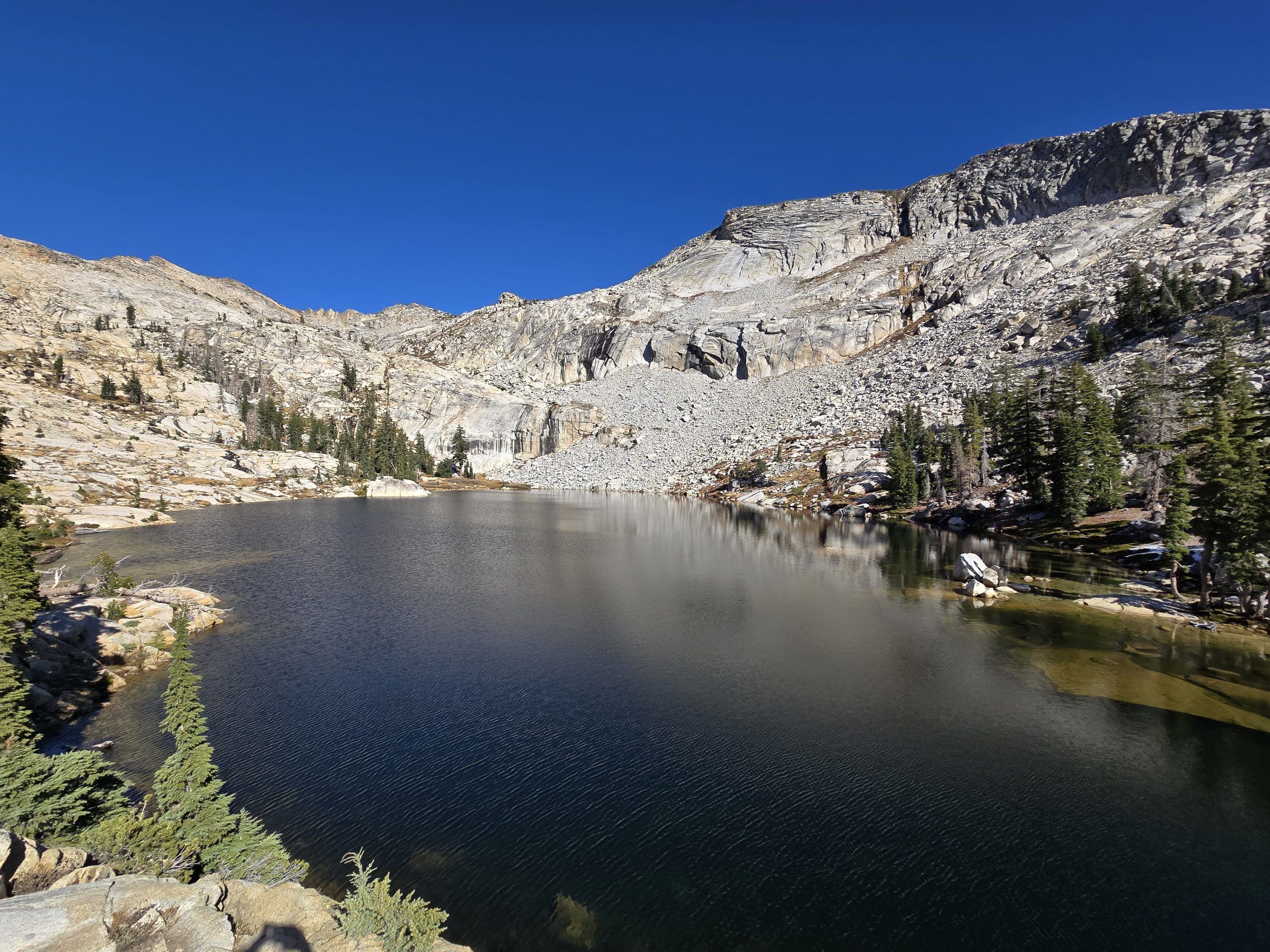
We finally crested the ridge with our fatigued legs and were rewarded with awesome views.


After we made our way down closer to the water, we found big boulders to sit on and have our trail snacks. There was a slight breeze in the air to cool us off. And the sun was hot.

We only sat for maybe 15 minutes, and then decided we’d better start climbing out of here before it starts to get dark. I looked at my watch and I told my husband we should try to hurry back because it’s already 6:00 p.m. He wondered why, because it won’t take us that long and we had enough daylight in front of us.
Most of the time, while I’m hiking, I’m thinking about food. I don’t know why. I just often think about what I’m going to eat after we’re done hiking. Today was no exception. I had my mind half set on stopping at our favorite BBQ restaurant on Hwy 395 on our way home and I wasn’t sure what time they closed, so I didn’t want to fully get my hopes up in case we didn’t make it there in time. But it was definitely on my mind and that can be a strong motivator to hike fast and get back to the trailhead.
With all of the rock faces and boulders, the trail can be less than obvious in this section, so we maneuvered our way in the general direction we knew we had to go.
Then we spotted this.

Creeeeepy. I don’t really need to be poking around a dark manmade cave.
Given the fact this was an out-and-back route, we revisited all the rockiness that was a significant part of this trail, cautiously descending, hoping not to bust an ankle or trip and fall.


The temperature was starting to drop a little bit, especially if you were in the shade. Two early-20-something girls dressed in shorts and tank-tops suddenly appeared behind us on the trail. They seemed like they were in a pretty big hurry to get back to the trailhead, so we stepped aside and let them go ahead of us. I am guessing they were getting pretty chilly by that time.
Once we reached the meadow again, we saw a dead mole on the forest road (I did not photo this!) and a couple of clusters of snow plants.

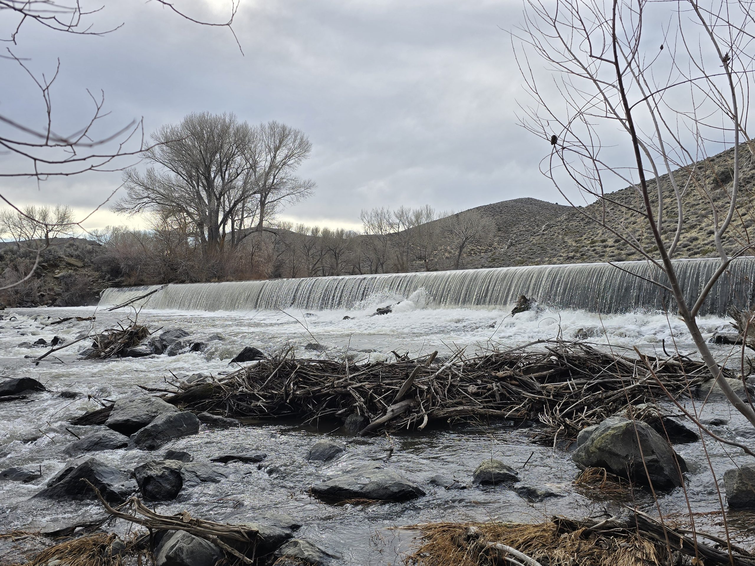
When we arrived back at the trailhead, I checked my fitness watch and the hike was exactly 6 miles roundtrip. We got in and headed back up the pass. On our way, we briefly stopped at the Leavitt Falls overlook, for nostalgia’s sake, to see how the waterfall was looking this spring. We’d stopped here a couple of times before and this was probably the most volume we have seen flowing here. We’ve also previously hiked around Leavitt Lake, as well as Leavitt Meadows.

Once we reached Hwy 395 again, we headed north in hopes that the BBQ restaurant would still be open, so we could enjoy a late dinner. When we pulled up, the sign still read “open,” so we went inside and sat in a booth. Our meals came out super fast and I devoured mine – one, because I was ravenous, and two, because it’s so delicious. As we were leaving the restaurant, we realized we had arrived a mere 20 minutes before closing time. What a lucky day!

| Kennedy Meadows to Relief Reservoir | |
|---|---|
| Total Distance | 6 mi |
| Total Time | 2:41:34 |
| Total Ascent | 1,171 ft |
| Max Elevation | 7,484 ft |
Leave a Reply