
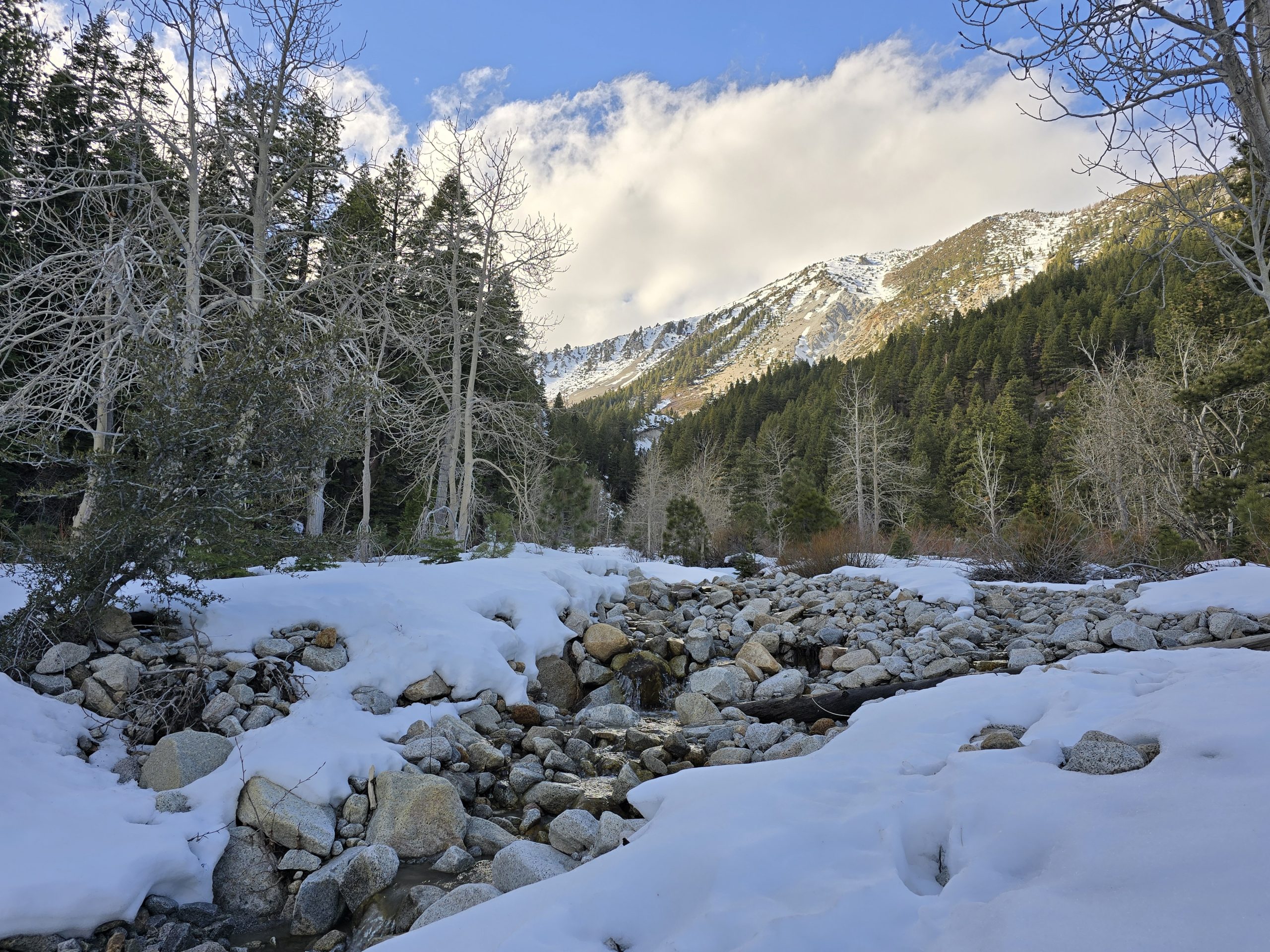
Earlier this morning, we finished our glacier/bristlecone hike in Great Basin National Park and then hit the road in the Jeep, heading for southern Utah via Hwy 50.
When we were planning out this road trip to Colorado, spending time in Arches National Park was high on our list, but we soon discovered that the park was under a timed reservation pilot program this year and all morning reservations the day we would be there were already “sold out.”
Reservations for Arches National Park
Because temperatures easily climb to over 100º F during the summer in Arches, we knew getting a morning time slot when it would be much cooler outside would be our best bet for hiking. As we read more information about the pilot program, we learned that if you go onto the reservation website at 6 p.m. the day before you want to visit the park, you might be able to get one of the last-minute tickets released at that time, but they sell out quickly.
The trouble with this strategy is that we would be on the road with no guarantee of ample internet connection required to complete this online transaction. We were watching the clock very closely so we didn’t miss our opportunity. At about 5:30 p.m., we’d just passed through a small, rural Utah town.
A few minutes down the highway later, our internet connection dropped. It was 5:45 p.m. We had no idea when we’d have internet again on this rural country route. So, we stopped the Jeep, made a U-turn, and drove until our connection came back, and then pulled off to the side of the two-lane highway and watched the clock.
We were surrounded by rural farmhouses and ranch land, seemingly in the middle of nowhere. Who knows why we got a decent internet connection in this spot.
Nervously refreshing the screen every few minutes, I had everything open in the reservation app on my phone, ready to select our desired 7 a.m. time slot. When 6:00 p.m. came, I refreshed once again and was pleased (and surprised) to see some tickets available in our popular time slot. With credit card in hand, I feverishly completed the payment form and clicked submit.
We got it. We were in. At 7 a.m. tomorrow morning, we’d gain entry into Arches National Park. I couldn’t believe it. What luck!
Scoring our pass into Arches was a huge win and now I felt like I could relax a little bit, knowing that potential obstacle was cleared.
Road Trip Scenery Along Hwy 50/I-70
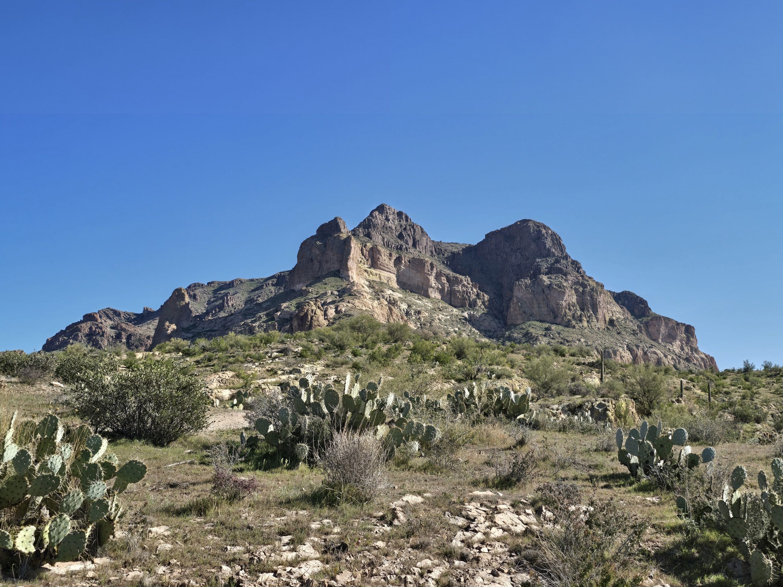
We continued along Hwy 50/I-70 and I was enamored with the sudden landscape change to imposing rock formations and then colorful canyons.


Our first glimpses of what we learned was Notch Peak. It looked really cool in the distance from the road as we approached.


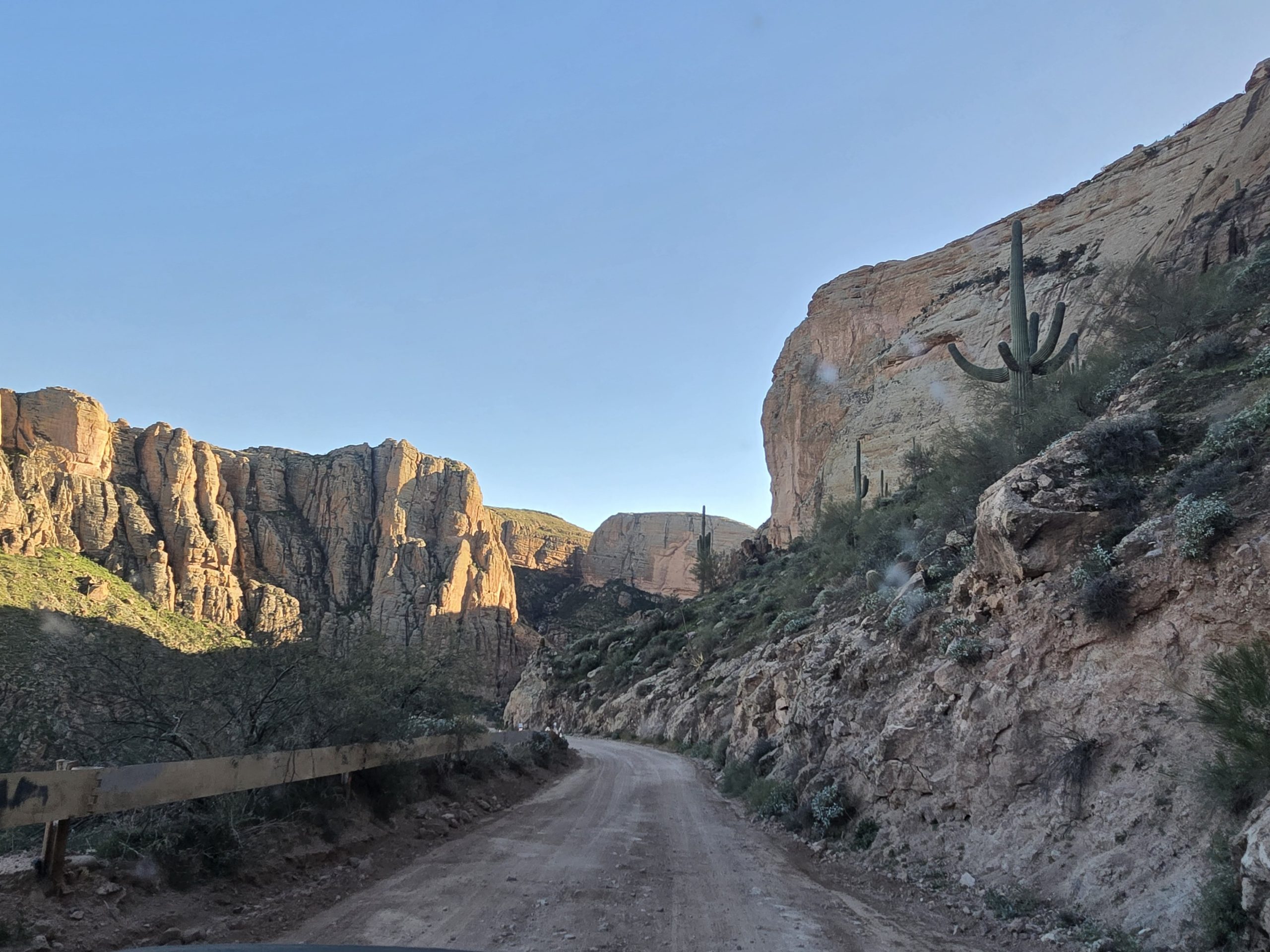
I love it when the road snakes alongside rock walls like this.


Even this flat desert sagebrush with some small mountains in the background is striking.

Southern Utah Roadside Canyons
As the sun began setting, we quickly made a few key stops at some of the popular roadside panoramic overlooks to take in the endless views of eroded sandstone formations, deep multi-colored canyons, prominent buttes and mesas – all formed through massive geologic upheaval about 60 million years ago – before dark.


Shadow dancing?


At the first canyon overlook, a Navajo woman was selling homemade jewelry, so my husband picked up a couple of items while I ventured out to take some photos of the canyon expanse before me. Just incredible. All of it.
The final stop we made before arriving in Moab, Utah, was the amazing Spotted Wolf Canyon overlook just as the sun was setting behind us.


Shortly after, we arrived in Moab and prepared to get up early the next morning to make our (lucky!) 7 a.m. Arches reservation.
Arches National Park

Even if hiking is not your thing, simply driving through Arches National Park is well worth it. The rock formations are like nothing I’ve ever seen before and to enjoy them you don’t even need to leave your car if you don’t want to. (Sorry about the dirty windshield in this one.)


But, we’re hikers, so we were looking forward to tackling the famous Delicate Arch hike.
Delicate Arch Hike
After winding our way through the park and marveling at the scenery, before 8 a.m., we found the trailhead parking lot for Delicate Arch and easily got a spot even though it was busy.
The first section of the trail goes past the old Wolfe Ranch cabin and then it pretty quickly introduces a steep switchbacked climb, which was oddly paved, before going back to dusty red dirt as you make your way across the “slickrock” surface to continue ascending to the arch 1.5 miles in.
This is early on in the hike, looking down at hikers coming up behind me.

Dozens of hikers making their way up the steep slickrock.

Looking back again.

A red rock formation along the trail.

A section of the slickrock trail.

Hikers winding their way around.

Climbing higher.

Another cool rock formation.

It was starting to get warm out and all the climbing made it feel pretty hot. I finally made it to the Delicate Arch. It’s massive and impressive, indeed. And you really need to watch your step (and don’t drop anything!) because most of the slickrock area around the arch is at some kind of downward angle that basically leads to a staggering drop-off far below.


This particular hike is likely one of the most popular in the park, and everyone was either jockeying for shade or waiting their turn for a photo op under the arch. I would say all were pretty courteous, however.

We spent some time enjoying the sights here and taking group photos for a few other people before heading back down the entirely descending route to the trailhead.
This one section of the trail was particularly striking. You’re walking on a narrow shelf of slickrock with an abrupt, steep drop-off on one side and an imposing rock wall on the other. On my way up to the arch, a young woman coming down this stretch exhibited wide eyes, labored breathing, and overly cautious steps. She was clearly terrified, so I hugged the side as best I could to allow her ample room to pass by.

Me descending the shelf.

Every aspect of this hike was memorable. From the unique terrain to the beauty of the landscape itself. Just awesome.

| Delicate Arch | |
|---|---|
| Total Distance | 3.36 mi |
| Total Time | 1:35:54 |
| Total Ascent | 607 ft |
| Max Elevation | 4,785 ft |
Once we made the final descent from Delicate Arch to the parking lot, an older man who had parked in front of our Jeep was busy cleaning the windshield of his sedan with a cloth and the aerosol cleaning agent he’d brought with him on his trip. Seeing this made my husband laugh, because he’d brought a similar cleaning agent on our trip and was considering doing the same chore, so he decided to make a joke to the man about it and we ended up striking a conversation with him.
Though his license plates read Alaska, he most recently lived in White Bear Lake, Minnesota, before building a cabin in The Last Frontier. We had all kinds of Midwest stories in common, including a close relative of his having attended the same university as my husband and I for our undergraduate degrees. Another “small world” encounter!
Balanced Rock Formation in Arches
Eventually, we got in the Jeep and headed back to the “Balanced Rock” formation we saw on our way in to get a closer look and take a few photos.

Before exiting the park, we made it down to the visitor’s center where we were pleased to find spigots for drinking water to refill our one-gallon travel jug. Then, it was time for some yummy breakfast at Moab Diner. Afterward, we continued on to the next national park of the day: Canyonlands.
Canyonlands National Park
The road to Canyonlands was picturesque.


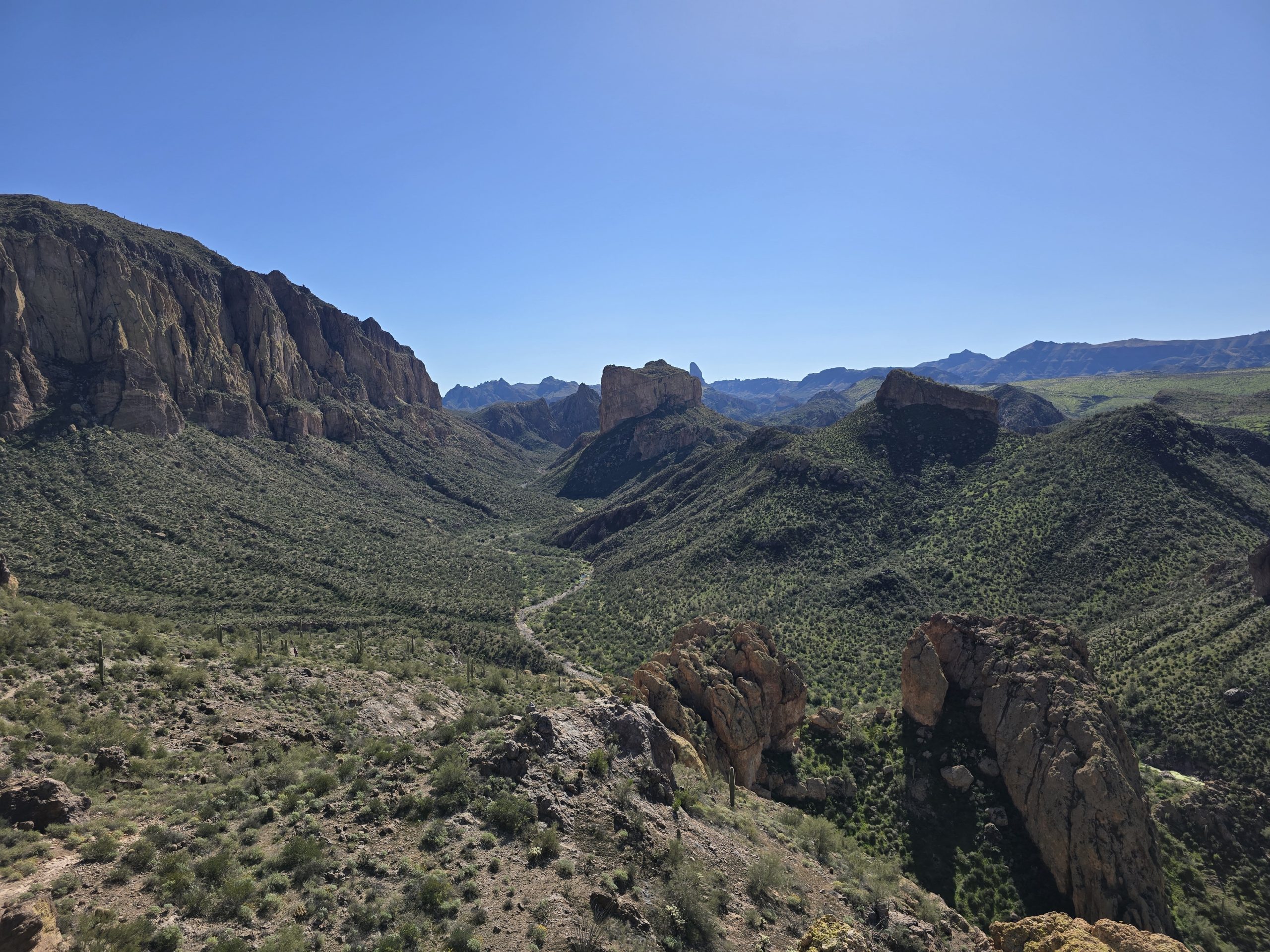
This visit to the Island in the Sky district of Canyonlands for us was less hiking and more driving and walking around and taking in the sights, but oh, were they something.


Standing on the edge of the world.

This is the Shafer Trail overlook point. A caravan of Jeeps are coming up the trail far down below. We hope to come back in the future and experience Shafer Trail for ourselves.


Such amazing panoramic landscapes. So vast and expansive. It’s very difficult to capture its magnitude in photos.
From Canyonlands, we returned to the highway and soon crossed over the border into Colorado. And because we still had daylight, we thought we’d stop at yet one more national park today: Black Canyon of the Gunnison.
Black Canyon of the Gunnison National Park

I had never heard of this park in Colorado, but I am so glad we ventured off the main highway to check out this amazing canyon.
The foundation of the rock of Black Canyon began forming nearly 2 billion years ago deep below the earth and is now comprised of some of the “steepest cliffs, oldest rock, and craggiest spires in North America.” Over 2 million years, the Gunnison River, along with the forces of weathering, created the canyon we see today.

The Gunnison River still flows at the bottom of the canyon.


Looking down at the Gunnison River.


We loved the light-colored “veins” that formed in this section of the canyon.

As the sun got lower in the sky, we left the park and continued our route to Gunnison, Colorado, where we would meet up with my husband’s aunt and uncle who drove from Minnesota for some more adventures, including more hiking and some super-sketchy Jeep roads.
Leave a Reply